Utah Weather Forecast: Rain, Snow, and Freezing Rain Expected for New Year's Day
Utah is set for a wet New Year's Day with rain, snow, and freezing rain impacting travel plans statewide.
As Utahans prepare to welcome the New Year, they should brace for a significant shift in weather conditions, transitioning from mild and dry to wet and wintry. According to the latest forecasts, high pressure currently over the state will allow temperatures to reach above average in many areas, but with notable exceptions due to persistent cold air trapped in the northern valleys by an inversion effect. This pattern has resulted in poor air quality across the region, but a changing weather system is expected to bring much-needed relief in the coming days.
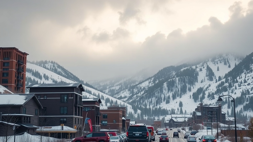
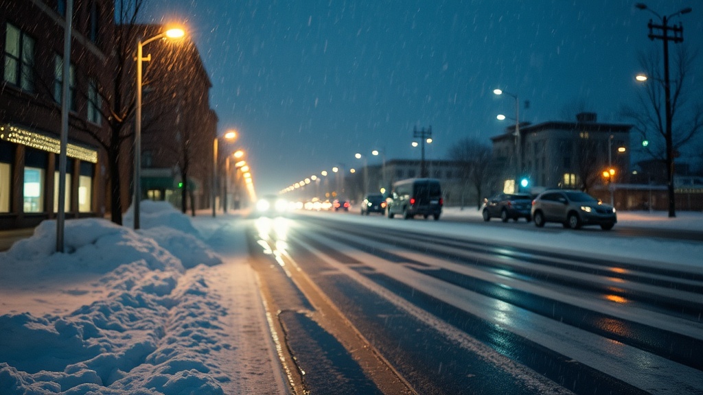
The National Weather Service has issued warnings about the potential for valley rain and mountain snow, which is expected to begin tonight and become widespread by early New Year's Day. Forecasters are particularly concerned about the possibility of freezing rain in colder valleys, which could create hazardous driving conditions early tomorrow morning. Areas most at risk include the northwest deserts and sections of Interstate 80, especially between Salt Lake City and the Nevada border. Freezing rain is also predicted for Castle Country, as well as parts of the US 89 corridor to the east of Kanab.
In higher elevations, snowfall is anticipated to be significant, particularly above 8,000 feet, where accumulations could range from 2 to 8 inches. This winter weather could impact outdoor plans and travel for those ringing in the New Year in the mountains, where conditions may be particularly treacherous.
In Salt Lake City, Wednesday's weather is forecasted to be partly cloudy, with high temperatures reaching the low 40s. However, as the clock approaches midnight, conditions are expected to shift, becoming mostly cloudy with temperatures dipping into the mid-30s. Rain is likely to begin after midnight, setting the stage for a rainy New Year's Day with highs in the mid to upper 40s.
Meanwhile, in St. George, the day will start with partly cloudy skies, transitioning to overcast by the afternoon. Highs are expected to reach the mid-50s. As midnight approaches, temperatures will cool into the upper 40s, with showers likely to begin shortly thereafter. New Year's Day in St. George will also see rain, with highs forecast in the low 50s.
As communities across Utah prepare for the wet weather, residents are urged to stay informed about changing conditions. The FOX 13 First Alert Weather app offers real-time updates and forecasts, which can be crucial for planning New Year's celebrations and travel. Those interested can also access an interactive radar tool on the FOX 13 website to track weather developments across the state.
Additionally, the potential for power outages due to the icy conditions has raised concern among residents. Rocky Mountain Power has provided resources for customers to stay updated on outages and safety protocols, emphasizing the importance of being prepared for sudden changes in weather.
As the New Year approaches, the anticipated weather changes remind us of the unpredictable nature of Utah's winters. While many may look forward to celebrating with friends and family, it is crucial to remain vigilant about the conditions that could impact travel and festivities. With the potential for icy roads and heavy snowfall in mountainous areas, Utahans are encouraged to exercise caution and plan accordingly.
In conclusion, while the transition into 2024 may be marked by an influx of rain and snow, it also presents an opportunity for Utah residents to reflect on the past year and prepare for the challenges and changes that lie ahead. The upcoming weather system could serve as a reminder of the beauty and unpredictability of Utah's winter climate, shaping how residents celebrate the New Year. As we bid farewell to 2023, let us welcome 2024 with care and precaution, while hoping for a safe and prosperous year ahead.