Park City Welcomes 2026 with Mild Weather and Incoming Storm
Park City welcomes 2026 with warm New Year’s Eve weather and an incoming storm, promising significant snowfall for the region.
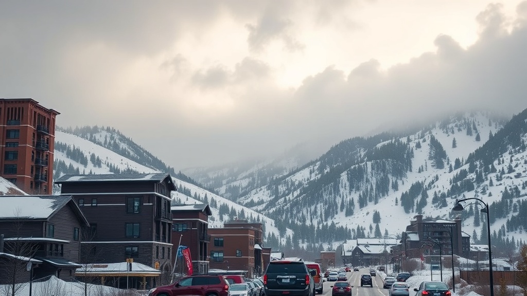
PARK CITY, Utah – As 2025 draws to a close, Park City residents and visitors can expect a surprisingly warm New Year’s Eve, with daytime temperatures peaking near 50 degrees Fahrenheit. This unseasonably warm weather is attributed to a high-pressure system that is momentarily settling over Utah, paving the way for a significant weather change as a warm closed-low pressure system approaches from the south. The combination of these weather patterns is set to influence the region's climate significantly as it ushers in 2026.
On New Year’s Eve, light southerly winds are forecasted to bring increased cloud cover to Park City, setting the stage for what many hope will be a snowy start to the new year. However, residents should be prepared for precipitation that is expected to commence right after midnight, continuing into the early hours of January 1. The warm air mass accompanying this storm will elevate snow levels to around 8,500 feet overnight, leading to a mix of rain and snow in the town initially, but the forecast indicates that rain will quickly dominate as temperatures rise.
In the Salt Lake Valley, conditions will remain notably stagnant on New Year’s Eve due to colder temperature inversions. This atmospheric phenomenon can lead to poor air quality, with increased haze becoming visible until the anticipated rainfall begins to clear the air overnight. Residents are urged to remain cautious, especially those with respiratory issues, as the stagnant air could exacerbate health concerns.
As the storm moves in, the forecast for snowfall over the following days is optimistic, with several mountain areas poised to receive substantial accumulations. Predictions for snow totals from Thursday to Friday indicate that Cottonwood Canyons could see between 7 to 14 inches, while Park City base and town may accumulate up to an inch. Deer Valley and Park City Mountain Resort are expected to receive between 5 to 9 inches, and the northern Wasatch area, including Powder Mountain and Snowbasin, could get around 6 to 12 inches.
The incoming storm is predicted to bring wet and heavy snow, particularly at higher elevations, which is expected to enhance skiing conditions in the mountains. However, the combination of warm air and precipitation could pose challenges for lower elevations, where the existing snowpack may be negatively affected by rain. Ski enthusiasts and locals alike are hopeful for a solid base-building snowfall, which could significantly improve conditions as more storms are anticipated later in the week.
Looking ahead, the snowfall is expected to remain steady from early New Year’s Day through the afternoon, with a second wave of precipitation forecasted to arrive overnight Friday into Saturday morning. As the low-pressure system tracks across central Utah, snowfall is expected to taper off by Friday afternoon. However, temperatures are anticipated to drop slightly, leading to lower snow levels, which may enhance snowfall potential in the Park City area during the later part of the storm.
Weather experts have indicated that there might be a window of northwest winds on Friday, which could favor upper Little Cottonwood Canyon, potentially increasing snow totals in that region. Meanwhile, the Park City mountains may initially see limited accumulations due to high snow levels, with better prospects for significant snowfall overnight Friday.
Despite the warm temperatures and challenging conditions, Utah's winter weather pattern appears to be active. After this current system exits late Friday into Saturday, a brief lull in activity is expected, but meteorologists are anticipating another wave of moisture late Sunday into Monday. The extended outlook shows a large low-pressure system moving south off the west coast, which could bring additional moisture into Utah.
Long-range forecasts indicate that the warm trend will continue into mid-January, raising concerns about the existing snowpack's sustainability. As the weather remains dynamic, the community is advised to stay updated on forecasts and prepare for changing conditions. Ski resorts and local businesses hope that the anticipated snow will not only improve skiing but also provide a boost to the local economy as visitors flock to experience Utah's winter wonderland.
As the clock strikes midnight and the New Year begins, Park City residents will not only celebrate new beginnings but also brace for the weather changes that could impact their winter activities. With rain and snow on the horizon, the community remains hopeful for a prosperous and snowy 2026.
In conclusion, while the warmth of New Year’s Eve may seem unusual, it serves as a reminder of the unpredictable nature of weather patterns in Utah. As residents embrace the New Year, they remain optimistic that the incoming storm will finally bring the winter conditions they have been eagerly awaiting.