Significant Storm to Bring Snow Across All of Utah, Advisories Issued
A significant storm is set to impact all of Utah, bringing snowfall that could affect morning commutes and road safety.
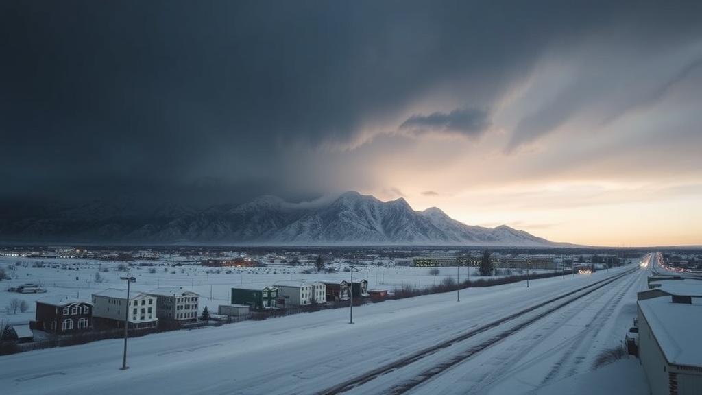
Utah is bracing for its first major storm of the season as a weather system moves into the state overnight on Wednesday, bringing significant snowfall that is likely to impact morning commutes on Thursday. The National Weather Service has issued a Winter Weather Advisory effective at 11 p.m. covering the entire I-15 corridor, from St. George in the south to Logan in the north, as well as areas to the east and west of this major highway. This storm marks a notable shift in weather patterns, with many regions in the state having remained relatively dry until recently, aside from a few sporadic days of rain.
As temperatures begin to drop significantly on Wednesday night, the northern valleys are expected to receive between 1 to 4 inches of snow. The snowfall will intensify in the early morning hours on Thursday, which could lead to hazardous driving conditions, particularly during peak commute hours. Residents in Southern Utah should prepare for snow as the storm progresses southward throughout the afternoon and evening hours.
Road conditions are anticipated to be challenging, with slushy or snow-covered surfaces complicating travel. Drivers are urged to exercise caution, as moderate traffic conditions are predicted statewide. However, higher traffic levels are expected in mountainous regions, where conditions may be particularly treacherous due to additional snowfall. In the Salt Lake Valley, lake effect snowfall might contribute to further complications, making it essential for drivers to stay informed and prepare for potential delays.
In the northern mountainous areas, forecasts indicate that some locations could receive up to an additional foot of snow, with the Cottonwoods and Bear River Range predicted to accumulate between 10 to 20 inches during this weather event. Central and southern mountain ranges are also expected to see significant snowfall, with estimates ranging from 4 to 8 inches. This influx of snow is welcome news for ski resorts and winter sports enthusiasts, as many had been concerned about the slow start to the winter season.
The storm is not just a fleeting event; it is set to bring about a notable change in temperatures as well. Northern Utah will see daytime highs remaining in the high 30s, while southern Utah can expect temperatures in the 40s through Monday. After this storm passes, forecasts predict a slight warming trend early next week, although the exact trajectory of temperatures remains to be seen.
The weather system is also accompanied by a series of advisories and alerts that residents are encouraged to monitor closely. The National Weather Service has emphasized the importance of staying informed about current weather conditions, especially for those planning to travel. The FOX 13 News Utah Weather Authority app is available for download to provide real-time updates on weather conditions and forecasts.
In addition to monitoring road conditions, residents are also advised to stay updated on potential power outages. With heavy snow and wind predicted, Rocky Mountain Power has made resources available for those affected by outages, and customers are encouraged to report any issues they may experience. As always, preparedness is key; families should ensure they have sufficient supplies in case of extended power outages.
Local authorities are expected to mobilize resources to address any issues arising from the storm, including snow removal and road maintenance. Public safety departments are already coordinating plans to ensure that roads are cleared as quickly as possible and that emergency services are prepared to respond to any incidents. Residents are reminded to keep emergency kits in their vehicles, including blankets, snacks, and water, in case they become stranded.
As Utah prepares for this significant weather event, the community is advised to take precautions and stay informed. With the potential for hazardous driving conditions, it is vital for residents to plan ahead, allowing for extra time during commutes and avoiding unnecessary travel if possible. This storm serves as a reminder that winter weather can change rapidly, and being prepared is essential for safety.
In conclusion, as the storm approaches, Utahns are encouraged to stay vigilant and proactive. By keeping informed and prepared, residents can navigate the challenges posed by this winter weather system effectively. As we welcome the first significant snowfall of the season, it is crucial to prioritize safety and community well-being during this time.
For those seeking more information, interactive radar and live traffic updates are available through FOX 13 News, providing essential resources for navigating the impending snowstorm.