Cold Front Brings Scattered Snow Showers to Utah: What to Expect This Weekend
Utah faces scattered snow showers Thursday evening as a cold front arrives, with drier conditions expected for the weekend.
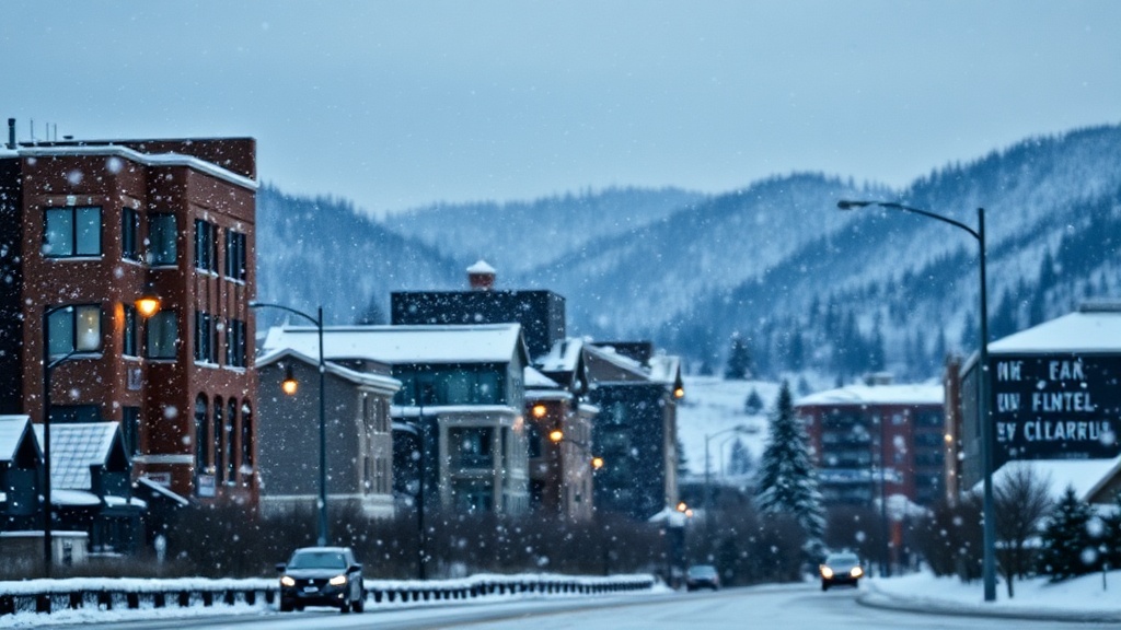
As Utah residents brace for a notable shift in weather patterns, a cold front has swept through the region, bringing with it scattered snow showers and plummeting temperatures. Meteorologists report that this change is a direct result of a cold front that has moved across the state, leading to a wintry mix that is expected to linger into the evening hours of Thursday. The snowfall, while not expected to accumulate significantly in most areas, serves as a reminder of the fast-approaching winter months.
According to the National Weather Service (NWS), the cold front has caused temperatures to drop considerably compared to earlier this week, with highs in some areas struggling to reach the mid-40s. In Salt Lake City, temperatures are expected to hover around 38 degrees Fahrenheit, accompanied by gusty winds that could make it feel even colder. "This is a classic case of a cold front moving in, bringing with it the potential for snow showers, particularly in the higher elevations. We're seeing a significant temperature drop that many residents may not have been prepared for," said meteorologist Kelly Johnson from the NWS.
The scattered snow showers are most likely to affect mountainous areas, especially the Wasatch Range, where several inches of snow could accumulate above 6,000 feet. Ski resorts in the region, such as Park City and Snowbird, are eagerly anticipating the fresh powder, which could enhance early-season skiing conditions. "Every little bit helps as we gear up for the winter sports season. We’re excited to see the snow, and we hope it continues into the weekend," said Sarah Mitchell, a spokesperson for the Park City Mountain Resort.
In contrast, lower elevations in the Salt Lake Valley may experience light rain mixed with snow, particularly during the evening commute. The NWS has issued advisories urging drivers to remain cautious as road conditions could become slick. "We encourage everyone to be mindful of the changing weather. If you’re out driving, make sure to leave plenty of space between your vehicle and the one in front of you," Johnson added.
Looking ahead to the weekend, residents can expect a return to drier conditions as high-pressure systems move in following the cold front. This shift is anticipated to bring about cooler but clearer skies, with daytime temperatures gradually rising to the low 50s by Saturday. "The weekend should provide a nice break from the snow, allowing families to enjoy outdoor activities without the weather being an issue," Johnson noted.
The impending clear skies are expected to provide a stark contrast to the wintry conditions experienced earlier in the week. Outdoor enthusiasts and families planning weekend activities can look forward to a mix of sunshine and cooler temperatures, making it an ideal time for hiking or visiting local parks. However, residents should remain prepared for the cold, especially in the early morning and evening hours when temperatures are likely to dip.
Seasonal changes in Utah often prompt discussions about the impact of weather on local agriculture and ecosystems. Farmers in the region are keeping a close eye on the weather patterns as they prepare for winter crops. "A good snowpack is vital for our water supply in the coming months. It’s essential for our irrigation needs in the spring and summer, so we welcome this snow, even if it’s just a little bit," said local farmer Jim Reynolds.
As the winter season approaches, the conversations around climate change and its impact on weather patterns in Utah continue to be relevant. Recent studies have indicated that while snowfall may vary year to year, the overall trend showcases a potential decrease in snowpack levels due to rising temperatures. This situation poses challenges for water resource management in a state that is already grappling with drought conditions.
In conclusion, while the scattered snow showers on Thursday evening signal the return of winter-like weather to Utah, the high-pressure system expected to follow will bring a welcome reprieve for residents looking to enjoy outdoor activities. As temperatures stabilize and conditions clear up, Utahns are reminded to remain safe and prepared for the fluctuating weather patterns that characterize this time of year. The anticipation of snow at ski resorts and the potential benefits for agriculture create a complex but hopeful narrative as the season progresses.