Utah Weather Update: Snow Forecasts for Mountains and Valleys This Week
Utah residents are advised to prepare for incoming snow and rain as a storm approaches later this week, impacting travel and conditions statewide.
As Utah transitions between weather systems, residents are advised to take advantage of the brief respite from storms today, with sunny skies expected across much of the state. However, meteorologists are forecasting a significant shift in conditions as a new storm front approaches late Wednesday, bringing rain and snow that could impact travel and outdoor activities.
The state is currently under the influence of high-pressure systems, resulting in a sunny and dry day. In Salt Lake City, temperatures are projected to reach near 50 degrees Fahrenheit, providing a pleasant environment for outdoor activities before the weather changes. According to the National Weather Service, Tuesday night will bring mostly clear skies with lows dipping into the mid-30s.
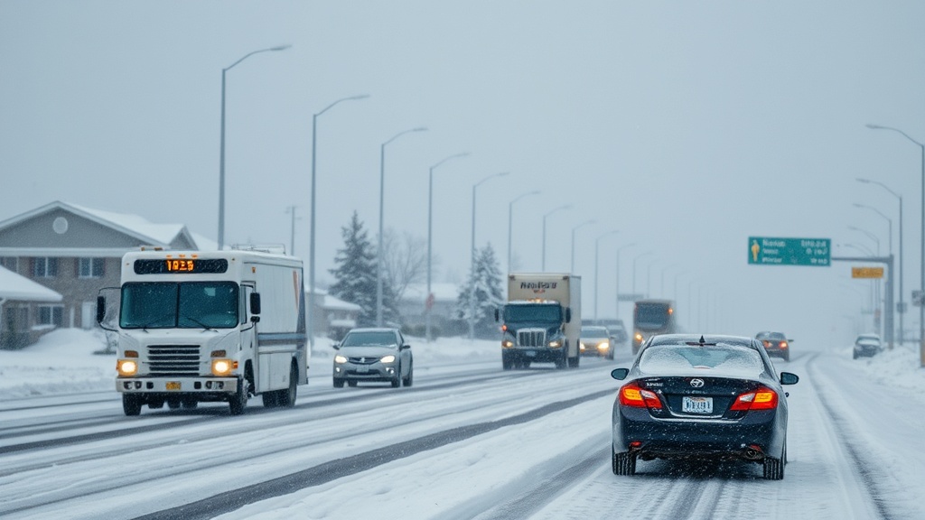
As the day progresses on Wednesday, changes will begin to unfold, with precipitation expected to start in the afternoon. Forecasters predict that rain will develop in the valleys while snow is anticipated in the mountain regions. This storm system will carry a cold front that is set to move in Thursday morning, crossing the state throughout the day. As temperatures drop, rain in the valleys is expected to transition to snow, with the possibility of varying precipitation levels based on geographical location.
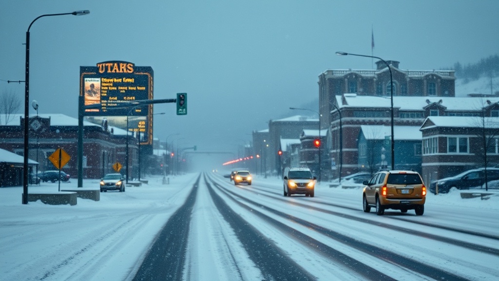
In southern Utah, particularly in lower Washington County, it is likely that temperatures and conditions will remain conducive to predominantly rain rather than snow. However, northern Utah is bracing for what could be the first significant winter storm of the season. Meteorologists estimate that valley locations could see accumulations of 1 to 3 inches of snow, while benches are expected to receive 3 to 6 inches. The mountain areas are forecasted to receive even more substantial snowfall, with estimates ranging from 6 to 12 inches. In particularly snow-prone areas such as the Cottonwood canyons, totals could reach an impressive 8 to 24 inches.
The potential for lake effect snow could further complicate conditions, especially in the Salt Lake Valley, on Thursday and again Friday morning. This phenomenon occurs when cold air flows over the warmer waters of the Great Salt Lake, potentially leading to enhanced snowfall in the region. The National Weather Service is closely monitoring this situation, as it could push snow totals higher than initially predicted, raising concerns for motorists and road conditions.
As the weekend approaches, weather conditions are expected to stabilize. Forecasts indicate a drying trend, with valley inversions becoming more likely, which can lead to fog and reduced air quality in some areas. It is essential for residents to stay informed as weather patterns can shift quickly, and conditions may warrant additional caution, particularly for those traveling through mountain passes and areas prone to winter weather hazards.
In St. George, the weather will differ from that in northern Utah, with partly cloudy skies and daytime highs reaching the mid-50s on Tuesday. Nighttime temperatures are expected to fall into the upper 30s, providing a contrast to the cooler conditions anticipated in the north as the storm arrives.
The community is encouraged to remain vigilant and prepared for changing weather conditions. Resources such as the Utah Weather Authority app provide real-time updates and forecasts, helping residents stay informed about the latest developments. Additionally, residents are urged to sign up for severe weather email alerts and to stay aware of potential power outages, particularly in areas expected to receive heavy snow.
As Utah prepares for this change in weather, the importance of being proactive cannot be overstated. Whether through checking road conditions, adjusting travel plans, or ensuring that homes are prepared for winter weather, residents are reminded to prioritize safety as the state navigates this anticipated storm phase. The upcoming days will likely test winter preparedness as Utahans brace for what could be a significant snowfall event across various regions of the state.
The collaboration between meteorologists and local authorities will play a crucial role in ensuring community safety, as timely updates and advisories will help mitigate the impact of these winter storms. With the right preparations, residents can enjoy the beauty of Utah's winter landscape while staying safe and informed during this seasonal transition.