Utah Braces for Rain and Snow: Storm System Set to Impact Travel
Utah is preparing for a storm bringing rain and significant mountain snow, impacting travel and safety across the region.
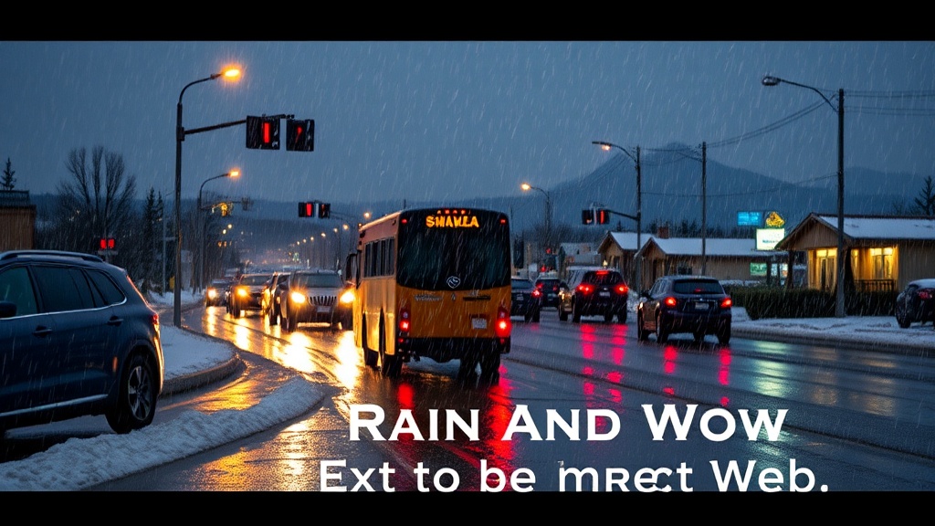
A significant storm system is set to impact Utah, bringing a mix of valley rain and substantial mountain snow. This weather event is expected to begin late today and continue through Monday, with the heaviest precipitation anticipated from late tonight into Monday morning, particularly across northern Utah. Meteorologists warn that travel conditions may become hazardous in mountainous areas due to slick roads and heavy snowfall.
The National Weather Service has issued a Winter Weather Advisory for the northern mountain regions, which will remain in effect until 11 PM on Monday. Snow levels are initially projected to hover around 7,000 feet but are expected to drop to between 6,000 and 6,500 feet by Monday. This fluctuation in snow levels indicates that lower elevations may also experience some snow accumulation. Forecasts suggest that areas in the northern mountains could see between 8 to 18 inches of snow by Monday evening, with potential for localized higher totals, raising concerns for those planning to travel in these regions.
In the valleys, precipitation is likely to be primarily rain, especially in locations along the northern Wasatch Front, Cache Valley, and the Wasatch Back. However, residents of Salt Lake and Tooele Valleys may not experience significant rainfall until late tonight. The rain is expected to taper off Monday afternoon and evening, providing a brief respite before another round of weather impacts the region.
Looking ahead, meteorologists note that Tuesday will bring a relatively calm day, characterized by milder temperatures and only a slight chance of lingering mountain snow showers across northern Utah. However, this tranquility is expected to be short-lived, as the weather pattern becomes more active midweek. A colder storm system is projected to arrive late Wednesday into early Thursday, potentially bringing lower snow levels and accumulating snow in the mountains. There is also a chance for valley snow across northern Utah by Wednesday night, which could complicate travel plans for residents and visitors alike.
Following this, a second, colder storm system is anticipated from Thursday into early Friday. This system may allow snow to reach valley floors, particularly in the northern Wasatch Front and adjacent bench areas. As weather conditions develop, meteorologists urge residents to stay informed and be prepared for possible impacts.
The impending storm has prompted local officials to remind the public to take necessary precautions, especially those planning to travel through mountain passes. Authorities are advising drivers to be equipped with winter gear, including chains and emergency kits, and to exercise caution on slick roadways. The combination of rain and snow is expected to create challenging driving conditions, particularly in the mountainous regions where visibility may be reduced and roads could become treacherous.
As the storm approaches, residents are encouraged to stay updated on weather conditions by utilizing the Utah Weather Authority app, which provides real-time forecasts and alerts. Additionally, interactive radar available through local news outlets can help individuals track weather changes as they occur.
The weather service continues to monitor the situation and will provide updates as more information becomes available. With winter conditions already impacting travel and daily activities in Utah, it is clear that the coming days will require careful planning and awareness to navigate the potential challenges posed by this storm system.
In conclusion, Utah's weather is poised for a dramatic shift as this storm system approaches, bringing the possibility of significant precipitation and travel disruptions. Residents are advised to remain vigilant, prepare for changing conditions, and stay informed through reliable weather updates as the situation unfolds. The upcoming storms serve as a reminder of the state’s dynamic weather patterns during the winter months, urging everyone to prioritize safety amidst the forecasted challenges.